Hiking the Jug Island trail in Vancouver BC
The Jug Island Trail in Belcarra Regional Park is a fantastic easy hike near Vancouver BC that is great if you’re looking for a hike with kids, your dog or just want something a bit easier.
It’s one of my favourite easy walks in Vancouver with minimal elevation, and rarely any snow making it a great Vancouver winter hike too.
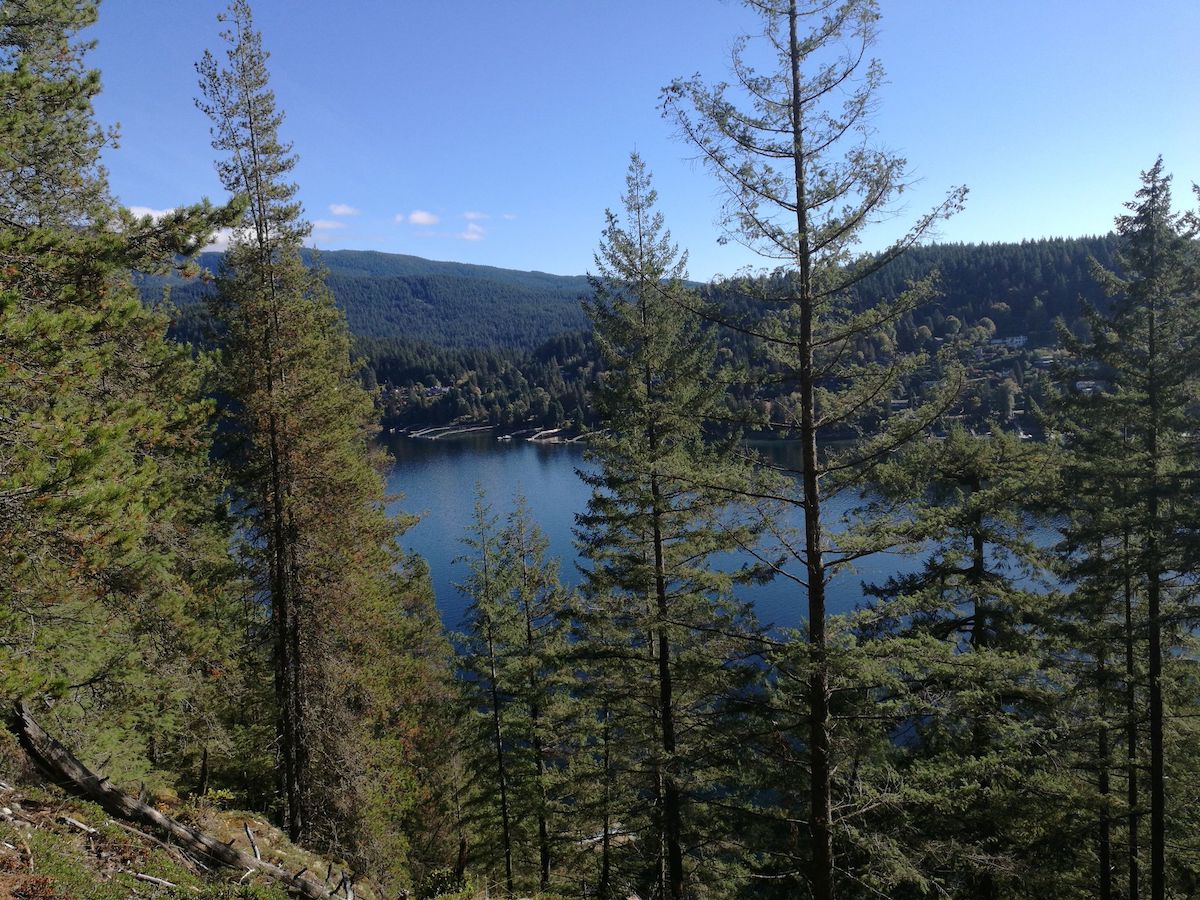
The hike itself takes you along the water of the Indian Arm, offering views of the surrounding mountains along the way. The trail is wide and well-maintained, making it accessible to most hikers.
As a result, it’s no surprise that the Jug Island Trail is a popular spot for locals and visitors.
On weekends and public holidays, the trail can get quite busy, but don’t let that discourage you. It’s still well worth the trip!
The first time I hiked the Jug Island Trail was with a friend on a sunny summer day. We set out early in the morning, hoping to beat the crowds, and were rewarded with a peaceful hike through the forest.
As we approached the beach, we could hear the sound of waves crashing against the shore. We spent some time lounging in the sun, taking a quick dip in the ocean, and enjoying the views of the Indian Arm and Deep Cove.
Whether you’re looking for a peaceful Vancouver winter hike or a sunny summer walk, the Jug Island Trail is the perfect spot. Grab your hiking boots and get ready to experience the magic of the trail for yourself

Jug Island trail overview
If you’re looking for a scenic and accessible trail in Greater Vancouver, the Jug Island Trail is definitely worth checking out.
Located in Belcarra Regional Park, this trail takes you through the forest and along the water of the Indian Arm, ultimately leading to a beautiful beach that overlooks Jug Island with a backdrop of Deep Cove and Indian Arm.
The trail itself is relatively easy, making it a great option for families, dog walkers, and outdoor enthusiasts of all levels.
While most people can’t access the island itself (it’s also pretty small so there’s not much there) the beach at the end of the trail is a worthwhile reward for the effort it takes to get there.
For those feeling particularly adventurous, it is possible to swim over to the island, but for most people, simply enjoying the views from the beach is more than enough.
As with many popular trails in the Vancouver area, the Jug Island Trail can get quite busy, particularly on sunny weekends.
Parking in the area is limited, so arriving early is recommended.
However, if you’re looking for a great rainy-day hike in Vancouver, this trail is perfect. The majority of the hike takes place in the forest, offering plenty of shelter from the rain, and the trail is still enjoyable even in wet conditions.
AllTrails is my go-to hiking app for finding, planning, and navigating while I’m out on the trails. With offline maps on AllTrails+ you can be confident you’re still on the right track, even without mobile signal.
How to get to the Jug Island trail head
Getting to the Jug Island Trailhead is relatively straightforward, but there are a few things to keep in mind to ensure you don’t end up in the wrong place.
If you enter “Jug Island Trailhead” into Google Maps, it will take you to the wrong side of the parking lot and you won’t be able to access the parking lot since there is a cement barrier to stop you. The road on this side is parking only so you can’t park here for the Jug Island trail.
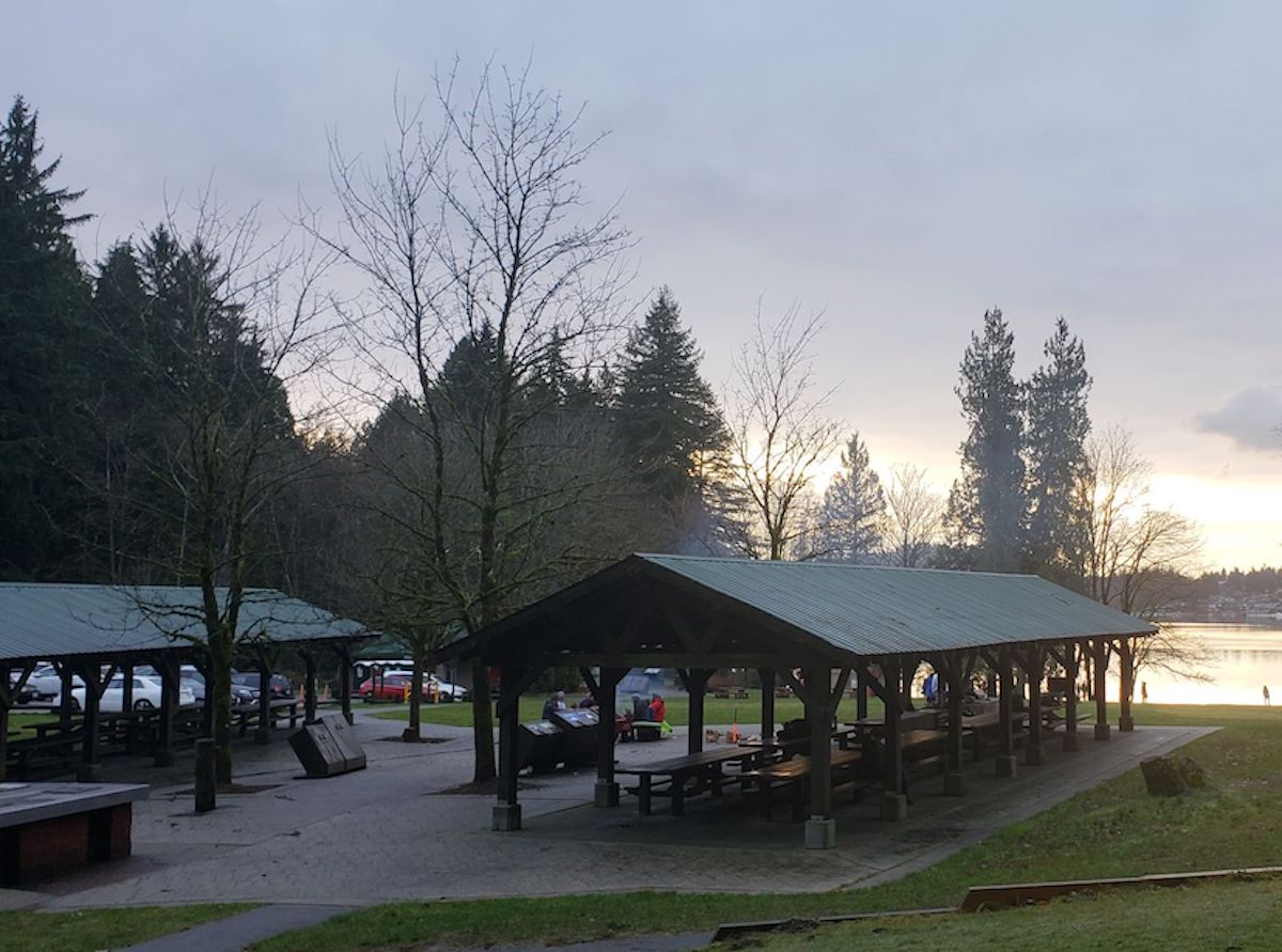
Instead, make sure you go to Belcarra Picnic Area, where there is a large parking lot as well as washrooms.
It’s a pretty scenic drive through the forest and is the same starting point as the Belcarra Bluffs Lookout trail.
To get to the trailhead, you will need to drive through Port Moody and pass the Shoreline Trail before turning onto Ioco Road to get to Belcarra Bay.
Stay on Ioco Rd for 4km before turning right on 1st Ave, which will later turn into Bedwell Bay Rd.
Shortly after the signs for Sasamat Lake, about 5 minutes before you reach the parking lot, there is a fork in the road.
Google Maps will tell you to go right, but make sure you turn left to go to the picnic area.
Once you arrive at the park, you will find a large parking lot. However, it does get busy on nice days, so be prepared to do a few laps before finding a spot.
There is a really nice park area here with picnic benches and a large grassy area right by the water, which is perfect for a sunny day. You’ll also find bathrooms in the park, which you can use before starting the hike, as well as a Jug Island trail map so you can see the route you will take.
If you prefer to take public transit, you’re in luck.
This is one of the Vancouver trails accessible by public transit.
Just take the Belcarra bus, which is bus 182, from the Moody Centre Skytrain station in Port Moody.
This bus will drop you right by the Jug Island trailhead, making it a convenient option for those without a car in Vancouver.
- Downtown Vancouver to Belcarra Regional park by car: 42 minutes
- Downtown Vancouver to Belcarra Regional park by public transit: 1 hour 22 minutes
Know before you go information
- There is no camping at Jug Island
- Always practice leave no trace ethics. Not sure what those are? Get a refresher here.
- Carry bear spray with you on all BC hiking trails. Get more bear safety tips here!
- Refresh your memory about hiking safety with BC Adventure Smart.
- Jug Island trail closed: Always check local park closures.
- Don’t leave home without your 10 essentials. They could save your life

Hiking the Jug Island trail, British Columbia
Hiking the Jug Island Trail in Vancouver is an easy hike with a total distance of 5.5 km and an elevation gain of 100 m. Below is some guidance when it comes to Jug Island trail directions.
From the Belcarra Picnic Area parking lot, you can easily spot the trail by following the marker pointing towards Jug Island from the east end of the picnic area.
The first 10 minutes of the hike will be a fairly steep climb up a wide gravel path through the moss-covered forest.
Although the steepest part of the trail, it doesn’t last long, and soon you will descend some stairs and along the trail to a bit of a valley.
The middle section of the hike is relatively flat and is again along a wide well-maintained trail. The trail gets rockier as you progress, making it unsuitable for wheelchairs or strollers.
After hiking for about 1.5 km, you will come across a fork in the trail and need to take the path to the right, which is marked with a signpost.
You will soon reach the top of a hill and begin the descent for the next 500m with some staircases thrown in on steeper parts.
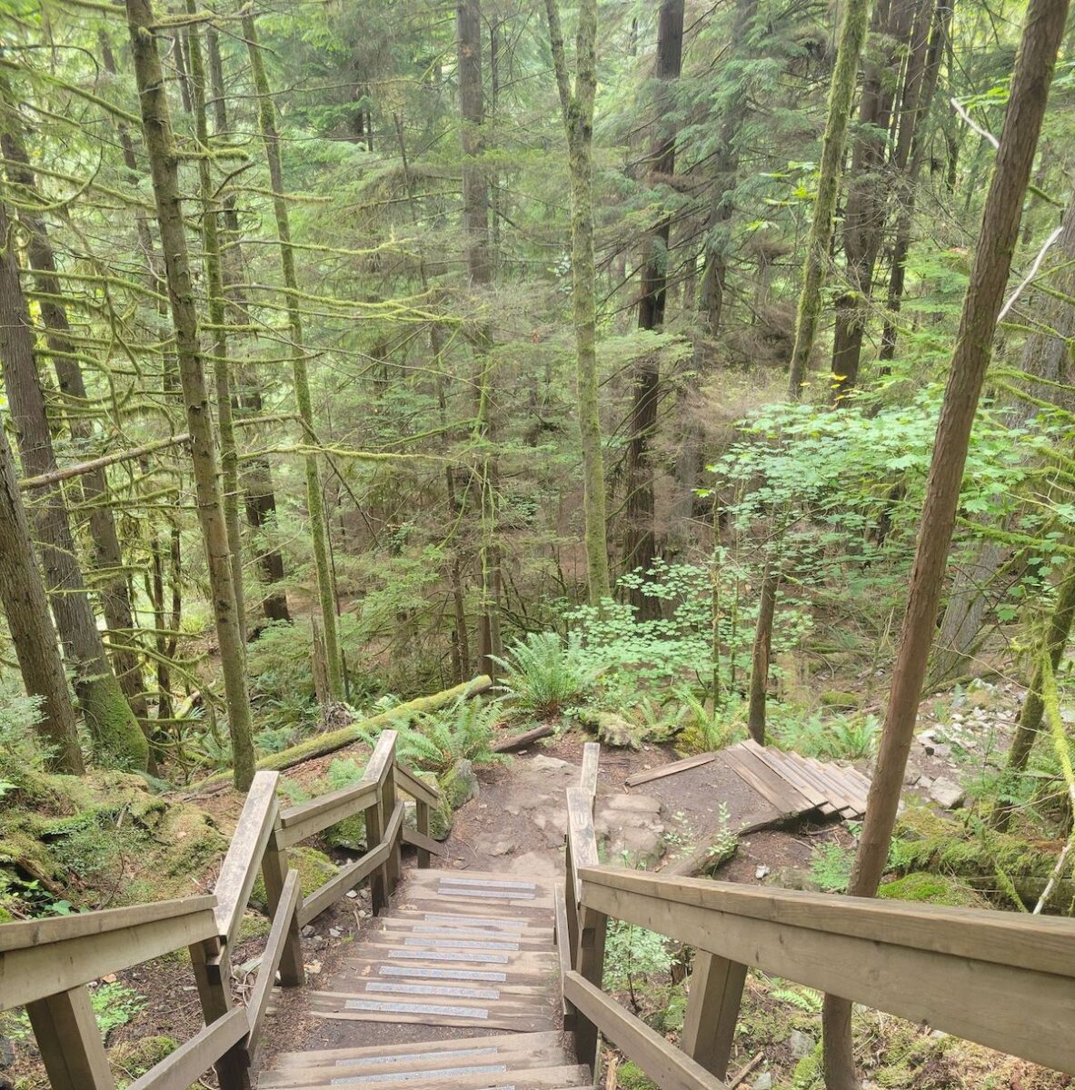
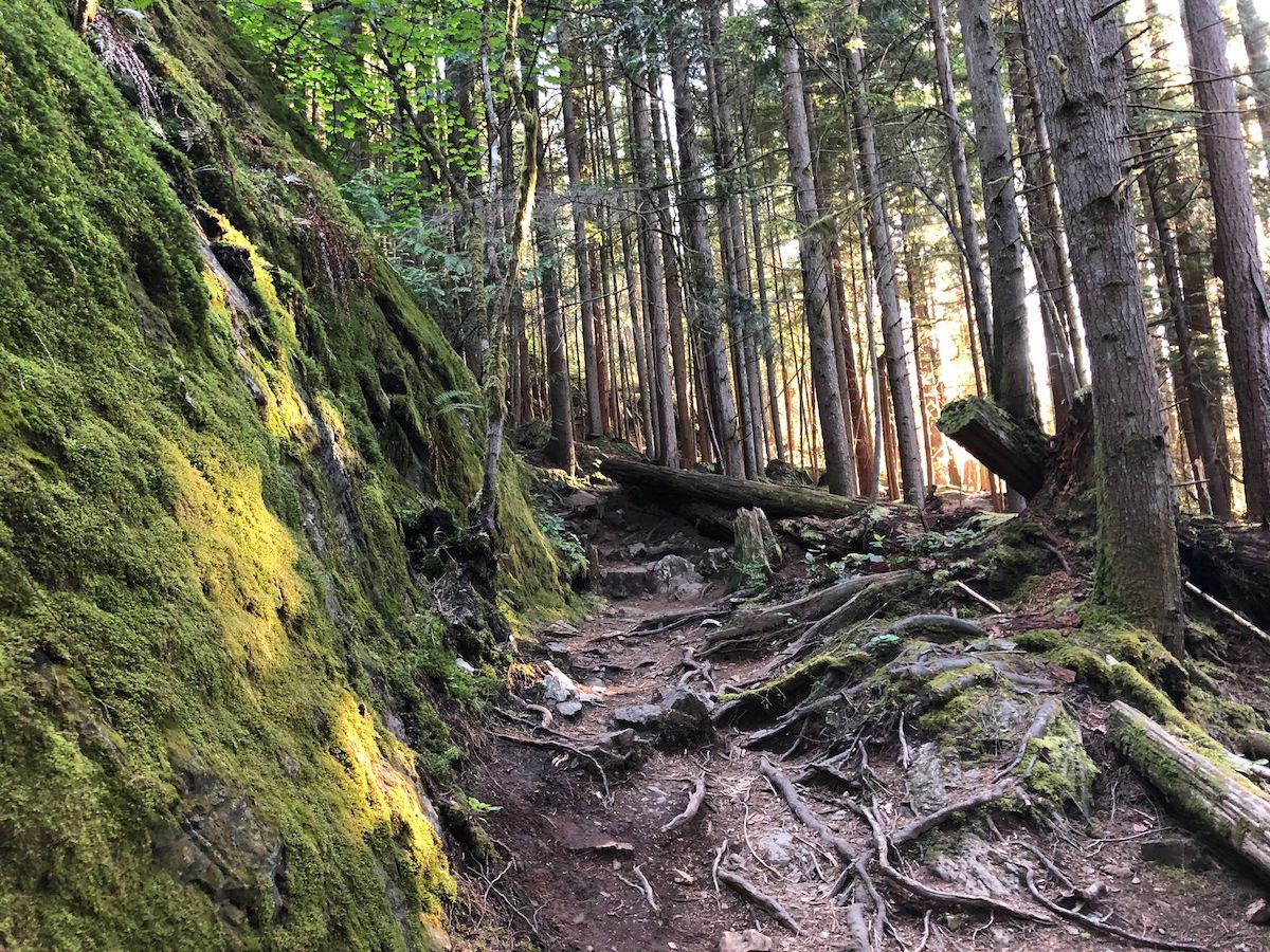
A small creek runs alongside the trail, making it very picturesque, but it can make the trail extra muddy in the spring. The trail also becomes rugged with a rocky ascent, and the whole trail will be a combination of rocks and mud, making it necessary to wear a good pair of hiking boots.
As you climb up again, you will start to see glimpses of Bedwell Bay to your right through the trees.
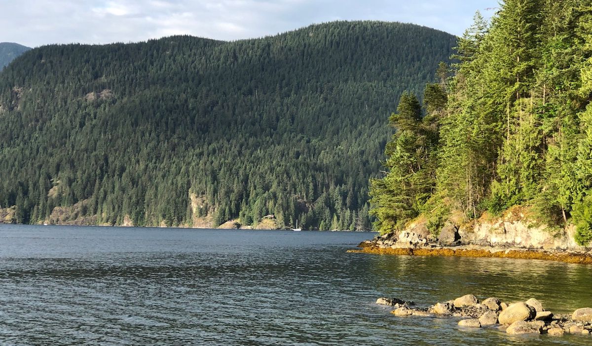
The fiscal descent on the Jug Island beach trail is the steepest part of the hike, but the views of Jug Island will get better as you approach. Once you reach the beach, you’ll get a great view of Jug Island and the Indian Arm.

It’s a popular spot for relaxing and enjoying the views, and you may see off-leash dogs and people swimming at the beach or even out to the island. Keep an eye out for seals and eagles if you’re lucky.
The waterway is quite busy, so you’ll likely see boats cruising by, as well as kayakers and paddleboarders in the summer.
The beach is an excellent spot to sit and enjoy a packed lunch or a quick snack as you take in the scenery.
It’s an incredibly beautiful place, and it’s amazing to have it accessible so close to downtown Vancouver and by public transit.
After resting up, it’s time to head back. Although the total elevation gain is much the same on the return leg, you may find it a little more challenging than the outbound journey.
The start is quite steep, but much of the elevation will be at the beginning, while the end will be easier as it’ll mostly be downhill.
The entire hike will take approximately 2 hours, depending on your speed, and the time you spend on the beach.
Whether you are a seasoned hiker or just looking for an easy/moderate-level hike to enjoy, the Jug Island Trail is a must-do when in Vancouver.
Jug Island trail stats
- Jug Island trail difficulty: easy
- Jug Island hike duration is about 2 hours to return to the parking lot
- Jug Island trail distance: 5km
- Elevation gain: minimal
- Jug Island trail address
- Jug island alltrails map
What to pack to hike Jug Island
What to pack for this hike depends on what season you’re hiking in.
- Check out my day hike packing list here.
- If you’re hiking in summer you should pack sunscreen, sunglasses, layers, water and bug spray as well as everything in the 10 essentials for hiking list.
- Here is what to wear hiking in hot weather
- Check out this post on the best leggings for hiking or what to wear hiking in summer for more details and my gear recommendations.
- If you’re hiking in winter after the snow has started falling you’ll need microspikes at the very least. If there is a lot of snow you will probably need snowshoes.
- You should also take plenty of layers including a fleece layer, a puffy insulated jacket and a wind and waterproof outer layer. Hats and gloves are also necessary as well as a good backpack to keep everything in.
- You should also pack water and some snacks too to keep you going as they’re part of the 10 essentials for hiking!
- Planning a hiking date? Check out what to wear on a hiking date but still look cool.
FAQs about the Jug Island trail in Vancouver
What is the Jug Island trail difficulty?
Is the Jug Island trail worth it?
The trail gives hikers a great view of the Indian Arm and Jug Island from the beach and you may even see seals and eagles! It’s a beautiful place that is easily accessible from Vancouver and can be reached by public transit.
Is Jug Island trail dog friendly?
Can you go on Jug Island?
How long is Jug Island trail?
Where is Jug Island Vancouver trail?
Final thoughts on Jug Island Belcarra
Jug Island Trail is a beautiful hiking trail located in Belcarra Regional Park, just outside of Vancouver, Canada.
The trail is 5 km long and takes about 2 hours to complete, including a stop at Jug Island Beach.
Overall, the Jug trail is a great hike for those looking for a moderate challenge with stunning views of the water, mountains, and wildlife.
A great nearby hike is the Admiralty Point Trail in Belcarra Park, or check out the lakes like Sasaamat Lake. Or, check out my guide to awesome spring hikes in Vancouver, where to go hiking in fall in Vancouver, and all my other hiking guides.
Looking for more things to do in Vancouver and nearby? Check out my Vancouver travel guides which are full of information on the best things to do in Vancouver, the best Vancouver restaurants, and detailed guides for each of the main neighborhoods.
Last Updated on September 14, 2023 by Hannah

Hannah started That Adventurer after graduating back in 2013 and has documented all of her adventures since then. From backpacking South America to city breaks in Europe, a 3 month road trip across the USA in a self-converted van and 6 years living in Canada, you’ll find posts on all of this.
Hannah specialises in active travel and on That Adventurer you’ll find hiking, walking, biking, skiing and all sorts of active travel guides to allow you to see a destination in an adventurous way.
Now back in Europe, you’ll find new guides as Hannah and her husband spend the next year ‘digital nomading’ from Norway to Portugal, Switzerland to Scotland and places in between.


