50+ Transit accessible hikes Vancouver has to offer!
Vancouver, BC is a city surrounded by beautiful nature in every direction, making it a hiker’s paradise. The great thing about hiking in Vancouver Canada is that there are plenty of hikes in close proximity to the city, and many of them are accessible by public transit.
This means that even if you don’t have access to a car, you can still explore some of the most beautiful transit accessible hikes Vancouver has to offer.
In this post, I’ll take you through the best Vancouver hikes accessible on public transit.
Many people living in Vancouver don’t have access to a car. Owning a car in Vancouver can be expensive, and if you live downtown, you don’t really need one.
Not having a car means your flexibility is a bit limited and it can make it challenging to explore some of the more remote hiking trails around Vancouver.
But don’t worry, with this list of transit-accessible hikes near Vancouver you’ll find plenty of hikes to try!
The list below includes over 50 hikes, and there are even more transit-accessible hikes near Vancouver.
Some trails are actually better on transit since parking can be a problem or expensive. There are even a few hikes that are best done as a one-way trip, which is much easier to do when you can take the bus to the start, and then get another bus at the end.
To plan your route, you can do some specific route planning directly on the TransLink website.
And once you’re ready to hit the trails, all you need is your compass card or a way of paying contactless/through tap!
There are plenty of options for hikes near Vancouver without owning a car and I’m about to share them with you.
Alternatively, you can take one of these guided hiking tours in Vancouver where transport is included for you and you have the added bonus of not needing to worry about bear safety and navigation!
Before you go hiking in Vancouver

It’s important to remember that just because a hiking trail is accessible by public transport in Vancouver, it doesn’t mean it’s any less wild or dangerous.
Some hikes on the list may have snowy conditions that can be hazardous during the winter or other hazards that can occur throughout the year. So it’s essential to research the trail conditions before heading out.
Checking the weather forecast beforehand is also important as it will help you decide what to wear to keep you warm and dry during the hike.
Carrying a backpack with the 10 essentials, which are the gear that every hiker should have, is a must.
Additionally, you should always inform a friend or family member of your trip plan, so someone knows where you are going and when to expect you back. Then, if you’re not back by the agreed time, they know to send help.
For the majority of these hikes, you should carry bear spray. Metro Vancouver is home to many black bears and I’ve personally seen quite a few while exploring the trails in North Vancouver. Be bear aware, carry bear spray and keep it in an easily accessible area while hiking.
Before you head out, make sure to learn about the Leave No Trace principles, which ensure that we can all enjoy the wild and beautiful outdoors while minimizing our impact on the environment.
When hiking via public transport, make sure you know the schedules and have a plan to get back from your destination. You don’t want to be stranded somewhere!
The duration of the hikes given below does not include public transportation time. It’s just the time it takes most people to complete the hike. Factor in the time to and from the trailhead from your home using Google Maps or Translink’s trip planning website.
AllTrails is my go-to hiking app for finding, planning, and navigating while I’m out on the trails. With offline maps on AllTrails+ you can be confident you’re still on the right track, even without mobile signal.
Using Vancouver’s public transit

When it comes to how to get around in Vancouver, BC you can use public transit to get to many of these hikes!
Bus schedules in Vancouver can change, so it’s always a good idea to double check schedules with Translink before taking transit to your hike.
To pay for public transit in Vancouver, you can use a Compass Card, which is a reloadable fare card that can be purchased at Skytrain stations.
You can also pay with Android Pay, Apple Pay and your usual credit or debit card as long as you have tap/contactless.
Getting around in Vancouver using public transit is easy and when it comes to how to get around Vancouver without a car, you can use public transit, car sharing or get a lift with friends!
Just tap your card when you get on a bus (you don’t have to tap out when using the buses.). Tap in and out of the gates at Skytrain and Sea Bus stations.
Make sure you use the same payment method to tap in and out or you’ll be charged the maximum fare.
Alternatively, you can pay with exact change when boarding a bus or purchase a single-use ticket from the machines at Skytrain stations and the Sea Bus.
North Vancouver hikes accessible by public transport
1. Grouse Grind

The Grouse Grind is one of the best hikes in Vancouver if you’re looking for a workout. It’s not got much in way of views until you’re at the top. But, what it does have are stairs. a whole lot of stairs.
The Grouse Mountain resort also offers a shuttle service during the summer.
Starting at the base of Grouse Mountain gives you access to other trails like the BCMC Trail, Baden-Powell Trail, and more.
- Trail stats: 3km (one way), 850m elevation gain, 45 minutes – 2 hours, difficult.
- How to get to Grouse mountain by bus: Take bus 236 from the Sea Bus to the base of Grouse Mountain. Or take bus 232 from Phibbs Exchange. You can also get the bus to Grouse Grind that’s offered by Grouse Mountain.
- More information about hiking the Grouse Grind
2. BCMC Trail

If you prefer a more rugged hiking experience than the Grouse Grind, the BCMC trail might be more to your liking. This trail is located east of the Grind and provides a much wilder experience.
It’s also one of the ways to come down from the top of Grouse Mountain since you aren’t allowed to walk down the Grouse Grind. Doing this can save you $20 on a download ticket for the gondola.
- Trail stats: 3km, 850m elevation gain, 2 hours, difficult.
- Getting there: Take bus 236 from the Sea Bus to the base of Grouse Mountain. Or take bus 232 from Phibbs Exchange.
- AllTrails map
3. Dam Mountain

Dam Mountain is a popular hiking trail located behind Grouse Mountain in North Vancouver. It’s the trail that’s used as the Snowshoe Grind; a popular winter hike in Vancouver, but it’s a great easy hike in the summer too.
- Trail stats: 5 km, 298 m elevation gain, 2 hours, easy-moderate.
- Getting there: Take bus 236 from the Sea Bus to the base of Grouse Mountain. Or take bus 232 from Phibbs Exchange.
- Dam mountain trip report
4. Thunderbird Ridge

Despite its proximity to Grouse Mountain Resort, the Thunderbird Ridge hike offers a wilderness experience and one of the best views in Vancouver.
The short hike culminates in a spectacular viewpoint high above Lynn Creek, with rugged terrain along the way.
I hiked this one evening when there was still snow on the trail and the sun was beginning to set, it was so pretty!
- Trail stats: 6km return, 190m elevation gain, 2.5 hours, moderate difficulty.
- Getting there: Take bus 236 from the Sea Bus to the base of Grouse Mountain. Or take bus 232 from Phibbs Exchange. Take the Grouse Gondola up to the resort or hike up the Grouse Grind or BCMC.
- More information
5. Little Goat Mountain

You can combine a second peak with Dam Mountain by hiking a little further onto Little Goat Mountain. The trail gets a bit more rugged, but it’s not too strenuous.
- Trail stats: 5.5km loop, 250m elevation gain, 2 hours, easy/moderate.
- Getting there: Take bus 236 from the Sea Bus to the base of Grouse Mountain. Or take bus 232 from Phibbs Exchange. Take the Grouse Gondola up to the resort or hike up the Grouse Grind or BCMC.
- AllTrails map
6. Goat Mountain

For a more challenging hike at Grouse Mountain, try Goat Mountain. The final section up to the summit involves a short scramble on granite rocks, making it a bit more challenging without being too extreme.
You can access the trail at the far end of the Grouse Mountain Resort, and the views of the city and mountains from the summit are stunning.
- Trail stats: 8km return, 300m elevation gain, 4 hours, moderate-strenuous.
- Getting there: Take bus 236 from the Sea Bus to the base of Grouse Mountain. Or take bus 232 from Phibbs Exchange. Take the Grouse Gondola up to the resort or hike up the Grouse Grind or BCMC.
- AllTrails map
7. Crown Mountain

Crown Mountain is known as one of the most challenging hikes on the North Shore due to a brutal descent into Crown Pass followed by a steep rock scramble to the summit.
The trail can be accessed from the Grouse Mountain Resort, and if you take the BCMC route, expect an additional 5km and 700m elevation gain.
The trail is 9km long from the resort and requires you to hike up the same trail as Goat Mountain before branching off to Crown.
The hike is one of the most challenging but best hikes North Vancouver has to offer and it has stunning views at the summit; as long as you’re there on a clear day!
- Trail stats: 10km return, 385m elevation gain, 7 hours, difficult.
- Getting there: Take bus 236 from the Sea Bus to the base of Grouse Mountain. Or take bus 232 from Phibbs Exchange. Take the Grouse Gondola up to the resort or hike up the Grouse Grind or BCMC.
- Crown Mountain hike guide
8. Capilano River Regional Park

Capilano River Regional Park offers a variety of trails that cater to different hiking preferences.
The park is home to the Cleveland Dam and salmon hatchery, and you can meander through moss-covered forests and picturesque bridges.
The trails offer beautiful attractions like rushing water, deep canyon walls, and whitewater kayakers. It’s one of my favourite places to walk in Vancouver on a rainy day.
- Trail stats: 2.5km loop, 100m elevation gain, 1+ hours, easy.
- Getting there: Take bus 236 from the Sea Bus. Get off on Nancy Green Way at Prospect Avenue.
- AllTrails maps
9. Norvan Falls

This hike starts from Lynn Headwaters regional park and is a great hike no matter the time of year
Hiking to Norvan Falls waterfall is great in the spring when the snow is melting and the falls are in full flow. But it’s also a great hike to do in the summer when you can cool off under the chilly falls. Though personally, my favourite time is to visit when Norvan Falls has frozen!
It’s quite a long trail, and there are roots and rocks to navigate, but there’s not a huge amount of elevation to contend with.
- Trail stats: 14km return, 195m elevation gain, 6 hours, easy-moderate.
- Getting there: Take bus 228 from Lonsdale Quay. Get off on Lynn Valley Road at Dempsey and follow Lynn Valley road or the Varley Trail into the park.
- Hiking Norvan Falls trail guide
10. Mount Fromme

Next door to Grouse Mountain is Mount Fromme. However, this hike is somewhat of a hidden gem that offers a quieter alternative to some of the North Shore’s more popular hikes.
To get to the peak of Fromme you’ll crisscross paths with mountain bikers heading up to get some fun descents on some of the best mountain biking trails in the North Shore.
- Trail info: 10km return, 880m elevation gain, 5 hours, moderate.
- Getting there: From Lonsdale Quay take bus 230 to Braemar Road at St. George’s Avenue. Walk up St. George’s for 600m to the trailhead.
- Mt Fromme trail guide
11. Lynn Peak, South Needle and North Needle

The Lynn Peak trail is a popular hike in North Vancouver, starting at the same place as Norvan Falls and Coliseum mountain.
It’s a steep trail in places and the view from the top of Lynn Peak isn’t the best, so some hikers choose to continue on to the South and North Needles for better vistas.
Once you reach Lynn Peak you’ll continue along the ridge going slightly up and down between mountain peaks.
Adding another 2km will bring you to South Needle for some fantastic views. You can continue a bit further to North Peak, but the trail becomes more rugged, so it’s only recommended for experienced hikers.
- Trail stats to Lynn peak: 9km return, 720m elevation gain, 4.5 hours, moderate/difficult.
- Getting there: Take bus 228 from Lonsdale Quay. Get off on Lynn Valley Road at Dempsey and follow Lynn Valley road or the Varley Trail into the park.
- Lynn Peak trail guide
12. Kennedy Falls

This trail always seems to earn a spot on the “best of” lists, whether it’s for waterfall hikes or Vancouver spring hikes or things to do on a rainy day in Vancouver.
With its stunning waterfall and towering ancient cedar tree, it’s easy to see why.
The trail itself is a rugged one that follows the path of an old logging road, leading you to the majestic cedar and the beautiful Kennedy Falls.
Keep in mind that the trail includes multiple stream crossings, so wearing proper footwear is a must. While this hike is suitable for any time of year, be aware that the dense forest means snow may linger longer than in the city during winter.
- Trail info: 10km return, 150m elevation gain, 5 hours, moderate.
- Getting there: Take bus 210 from downtown Vancouver to the top of Mountain Highway at Coleman Street. Walk 900m up Mountain highway to the trailhead and parking lot.
- Kennedy Falls trail guide
13. Coliseum Mountain
If you’re looking for a trail that’s less crowded than some of the more popular North Shore hikes, Coliseum Mountain is a great choice.
The hike to the top is long and strenuous, but the views from the summit are among the best in the area.
The first 6km or so of the Coliseum trail follows the Norvan Falls trail, but after that, it becomes significantly more challenging.
This trail requires a full-day commitment, so plan accordingly if you’re taking public transit.
However, the panoramic 360-degree views from the top make the effort well worth it.
- Trail stats: 22km return, 1245m elevation gain, 10+ hours, difficult.
- Getting there: Take bus 228 from Lonsdale Quay. Get off on Lynn Valley Road at Dempsey and follow Lynn Valley road or the Varley Trail into the park.
- AllTrails guide
14. Hanes Valley

For those seeking a challenging and unique hiking experience that’s easily accessible via public transit, the Hanes Valley trail is an excellent option.
This one-way trail starts at the Lynn Headwaters parking lot and finishes at Grouse Mountain, taking you through the rugged and breathtaking Hanes Valley.
Since the trail is point-to-point, it’s ideal for those relying on public transit, as even those driving would likely need two cars to complete the hike.
The trail follows the river and wraps around the back of Grouse Mountain, ending at Grouse Mountain Resort where you can take the gondola down or add an extra 3km to walk down the BCMC trail and catch a bus back home.
This hike is extremely challenging and remote with navigational difficulties. Do not attempt this if you’re not experienced in hiking difficult hikes near Vancouver. This hike closes seasonally over winter, do not hike it if it’s not open!
- Trail stats: 15km one way, 1320m elevation gain, 8.5 hours, difficult.
- Getting there: To start take bus 228 from Lonsdale Quay. Get off on Lynn Valley Road at Dempsey and follow Lynn Valley road or the Varley Trail into the park. To finish take the gondola down to the base of Grouse Mountain, then take bus 236 to the Sea Bus or bus 232 to Phibbs Exchange.
- AllTrails map + details
15. Baden Powell: Grouse Mountain to Deep Cove

For a hike that traverses the lower slopes of Fromme and Grouse Mountain while intersecting numerous mountain bike trails, the Baden Powell trail is an excellent choice.
This section of the trail is easily accessible via public transit and stretches across half of the North Shore from Grouse to Deep Cove.
The lush greenery of the area is especially captivating on rainy days, and the quiet atmosphere makes it a perfect escape from the city.
I ran this section of the Baden Powell a few years ago and it’s so pretty to be in amongst the forest.
- Trail stats: 22 km one way, 939 m elevation gain, 4-6 hours, moderate.
- Getting there: To start, take bus 228 to Lynn Valley Road at Peters Road. Follow Peters road into Lynn Canyon Park. To finish, take bus 236 to the Sea Bus or bus 232 to Phibbs Exchange from the base of Grouse Mountain.
- Read more about this section of the Baden Powell trail
16. Lynn Canyon & Twin Falls

Hiking to Twin Falls near Lynn Canyon is a popular year-round activity in North Vancouver, offering stunning views of cascading water from a vantage point.
The trail crosses over the Lynn Canyon Suspension Bridge and follows Lynn Creek, providing a beautiful experience in the lush, green surroundings of Lynn Canyon.
It’s a great alternative to Capilano Suspension Bridge too.
- Trail stats: 3 km, minimal elevation gain, 1-3 hours, easy
- Getting there: To get to Lynn Canyon take the 227 bus to Duval road and walk the last 500m or so to Lynn Canyon Park.
- Read more about Lynn Canyon Suspension Bridge
17. Lynn Loop & Rice Lake

Hiking the Lynn Loop and Rice Lake trail is a popular day trip in North Vancouver that offers beautiful scenery and easy-to-moderate terrain.
The Lynn Loop portion of the trail is a 5.1 km loop that takes hikers through the lush forest of Lynn Canyon and over a suspension bridge.
Rice Lake, a peaceful and serene spot, can be reached via a short 30-minute hike from the Lynn Loop trailhead and offers a relaxing place to rest and enjoy the scenery.
- Trail stats: 6-7 km, 160m elevation gain, 2.5 hours, easy.
- Getting there: Take bus 228 from Lonsdale Quay. Get off on Lynn Valley Road at Dempsey and follow Lynn Valley road or the Varley Trail into the park.
- Read more about Rice Lake
18. Lower Seymour Conservation Area

Biking and hiking in the Lower Seymour Conservation Area in North Vancouver is a great way to experience nature without leaving the city.
The park offers over 10 kilometres of hiking trails (one way) with varying difficulty levels that wind through beautiful forests and along the Seymour River.
You can hike on a paved trail all the way to the Seymour Dam which has some great views! As you hike you can enjoy stunning views of the surrounding mountains and river, and may even spot some wildlife along the way.
- Trail stats: 5km, 160m elevation gain, 2 hours, easy.
- Getting there: Take bus 228 from Lonsdale Quay. Get off on Lynn Valley Road at Dempsey and follow Lynn Valley road or the Varley Trail into the park.
- Read more about this trail
19. Quarry Rock hike

*Quarry Rock reopened March 2023*
Quarry Rock is a popular and easy hike located in Deep Cove, Vancouver.
The viewpoint at the top offers stunning views of Indian Arm and the town of Deep Cove.
Once the trail reopens, make sure to stop by Honey’s Doughnuts for a well-deserved treat after your hike!
- Trail stats: 4km return, 100m elevation gain, 1.5 hours, easy.
- Getting there: take the 211 or the 212 bus from Phibbs Exchange on the North Shore
- Quarry Rock trail guide
West Vancouver hikes accessible on public transit
20. Whyte Lake Trail

The Whyte Lake Trail is a popular hiking destination in West Vancouver, British Columbia.
It is a well-maintained trail that winds through a beautiful coastal forest and provides hikers with scenic views of the lake and surrounding mountains.
The trail is relatively easy and suitable for hikers of all skill levels, making it a great option for families and casual hikers.
It’s a great transit accessible hike in Vancouver.
- Trail stats: 5 km round trip, 1-2 hours, minimal elevation gain and an easy hike.
- Getting there: Take the 250 from downtown Vancouver towards Horseshoe Bay then get off at
WB Marine Dr @ Cranley Dr - Read more about Whyte Lake
21. Baden Powell Trail: Horseshoe Bay to Grouse

Hiking the Baden Powell trail from Horseshoe Bay to Grouse Mountain is a challenging but rewarding hike accessible on transit in Vancouver that showcases the natural beauty of Vancouver’s North Shore.
With a large elevation gain and rocky terrain, this hike is not for the faint of heart, but the stunning views and diverse terrain make it a must-do for experienced hikers.
- Trail stats: 22 km one way, 1337 m elevation gain, 3-5 hours, moderate.
- Getting there: To get to the Horseshoe Bay park and ride you can take the 250 bus to Horseshoe Bay from downtown Vancouver. You can get off the bus just as it leaves the highway, but if it continues down to Horseshoe Bay like it did when we did this trail you can follow some stairs back up to the main road and cross underneath the highway to access the trailhead
- Read more about this section of the Baden Powell trail
22. Lighthouse Park

Lighthouse Park is a must-visit spot for hiking enthusiasts in West Vancouver and the best part is it’s a Vancouver hike that’s accessible by public transit.
This park boasts stunning old-growth forests with some of the largest trees on the North Shore and has several trails to explore. From the trails, you can enjoy breathtaking views of the Salish Sea, downtown Vancouver, Stanley Park, Howe Sound, or Burrard Inlet.
You can take a leisurely stroll or a longer hike that can range from 500m to 6km, and it’s great for families on any day, rain or shine.
Apart from the beautiful natural scenery, Lighthouse Park also features a historic lighthouse built in 1912, sitting atop Point Atkinson.
- Trail stats: varies (4 – 6 km), 1-2 hours, minimal elevation gain and an easy hike.
- Getting there: Take bus 250 from downtown Vancouver. Get off at the Beacon Lane stop on Marine Drive in West Vancouver, then walk down Beacon Lane into the park. The parking lot fills up on summer weekends, so take transit instead.
- Read more about Lighthouse Park
23. Brothers Creek
Brothers Creek Trail is a beautiful hiking trail located in West Vancouver. The trail takes you through beautiful old-growth forests and follows Brothers’ Creek as it flows down from the mountains.
The trail is well-marked and has several viewpoints and rest areas along the way. One of the highlights of the trail is the stunning waterfall that can be seen from the trail. The waterfall is a popular spot for taking photos and enjoying the scenery.
You should be prepared for some steep sections and uneven terrain, but the trail is generally considered a great option for those looking for a intermediate hikes Vancouver has to offer with beautiful scenery.
- Trail stats: 7km loop, 350m elevation gain, 4 hours, moderate.
- Getting there: Take bus 254 from Park Royal to the stop at Eyremount Drive and Crestline Road. Walk up Crestline Road, then turn left on Henlow Road. Turn right on Millstream Road, then continue on Millstream for 100m. Turn left at the fork to reach the trailhead.
- Brothers Creek trail report
24. Cypress Falls

Hiking to Cypress Falls in West Vancouver is a wonderful adventure for nature lovers looking for hikes on transit near Vancouver.
Along the way, you’ll pass through a beautiful forest, crossing several bridges and creeks before arriving at the stunning 30-metre waterfall.
The view of the waterfall is absolutely breathtaking and a perfect place to relax and enjoy the beauty of nature.
There’s is rock climbing tucked away in this park and even an old car is hidden away in the forest around the falls!
- Trail stats: 3km round trip, 130m elevation gain, 1.5 hours, easy hike.
- Getting there: Take bus 253 from Park Royal. Get off on Woodgreen Drive at Woodgreen Place, then walk 1 block down Woodgreen Place to the park.
- Read more about Cypress Falls
25. Eagleridge Bluffs from Horseshoe Bay

Eagle Bluffs can be reached via two different routes – the popular one from Cypress Mountain Resort, and an alternative route starting near the Horseshoe Bay park and ride.
While the latter is more challenging with 11km and 1000m elevation gain on the Baden Powell trail, it offers stunning views at Eagle Bluffs and can be hiked earlier in the year due to starting at sea level.
It’s also the one that’s easiest to get to via public transit!
- Trail stats: 10.5 km return, 987 m elevation gain, 5-6 hours, difficult.
- Getting there: To get to the Horseshoe Bay park and ride you can take the 250 bus to Horseshoe Bay from downtown Vancouver.
- Read about Eagleridge Bluffs
Best transit accessible walks in Vancouver
26. Pacific Spirit Park

Pacific Spirit Regional Park is a vast forested area located near UBC, covering over 750 hectares. It’s a popular destination for year-round jogging and walking due to its numerous trails.
You can choose from a variety of routes to explore and can start from several trailheads.
Despite being situated near the city, the park’s forested trails provide a refreshing natural escape. It’s super dog friendly too with many off-leash trails for dogs.
- Trail stats: varies, minimal elevation, easy
- Getting there: There are numerous trailheads for the park and tons of options for getting there. Any UBC-bound bus will get you in the right area.
27. Stanley Park

Stanley Park is a popular destination in Vancouver known for its famous seawall walk, but the park also offers beautiful forested trails in the interior.
You can combine multiple trails to create a loop and enjoy the scenic views.
For tourists looking for an easy hike, Stanley Park is a great option and it’s one of my top things to do in Vancouver if you only have 1 day.
With different access points and bus lines nearby, it’s easy to get to Stanley Park using public transportation from various locations in Vancouver.
- Trail stats: 6km+ loop, minimal elevation gain, 1-3 hours, easy.
- Getting there: Take bus 19 from downtown Vancouver.
- Biking Stanely Park or read more about things to do in Stanley Park
Bowen Island & Sunshine Coast hikes accessible by transit
28. Mount Gardner

Mount Gardner on Bowen Island is a 17km hike with almost 800m of elevation gain, offering spectacular views of Vancouver, the Sunshine Coast, and Howe Sound Islands.
It is accessible year-round and is a super enjoyable hike since you can combine it with a day trip to Bowen Island.
There are shorter hikes on Bowen Island that can be explored as well.
To reach Mount Gardner your trail starts almost as soon as you get off the ferry. You’ll walk up through Snug Cove and towards Killarney Lake before climbing up to the peak of Bowen Island: Mount Gardner.
- Trail stats: 17km round trip, 719m elevation gain, 7 hours, the difficulty is moderate.
- Getting there: From downtown Vancouver, take bus 257 or 250 to Horseshoe Bay, then take the Bowen Island ferry as a foot passenger. Parking at the ferry is difficult and expensive so taking the bus is much easier. Use the AllTrails app or the maps on the island near the ferry terminal to navigate to the trailhead.
- Mount Gardner hike report
29. Killarney Lake

The Killarney Lake hike on Bowen Island is an easy and flat trail that makes for a great day trip from Vancouver without a car. The trail surrounds the beautiful Killarney Lake and offers scenic views of the surrounding forest.
The hike is approximately 9 kilometres round trip and takes about 2 hours to complete. There is no elevation gain on this hike, making it accessible for hikers of all skill levels.
- Trail Stats: 9km round trip, 2 hours, minimal elevation and an easy hike.
- Getting there: From downtown Vancouver, take bus 257 or 250 to Horseshoe Bay, then walk on to the Bowen Island ferry.
- AllTrails map
30. Langdale Falls

The Langdale Falls hike is a popular trail located on the Sunshine Coast that takes you through beautiful mossy forests to a picturesque waterfall.
The trail has a relatively low elevation gain, making it accessible to hikers of all levels, and can be hiked year-round.
The stunning scenery, peaceful environment, and easy accessibility make it one of the best hikes in the Sunshine Coast region accessible by public transit.
- Trail stats: 8km round trip, 3 hours, 280 m elevation gain and an easy hike.
- Getting there: From downtown Vancouver, cycle or take bus 257 or 250 to Horseshoe Bay, then walk or cycle on to the Sunshine Coast ferry
- Read more about the Sunshine Coast
Best hikes on public transport near Vancouver – Metro Vancouver
31. Burnaby Mountain

Burnaby Mountain is a popular hiking spot with several trails that offer panoramic views of the city and the surrounding mountains.
The most popular trail is the Burnaby Mountain Urban Trail, a 2.5 km loop that takes about an hour to complete.
- Trail stats: kilometres and distance vary depending on which way you go. Most trails are easy.
- Getting there: You can take the SkyTrain to Production Way-University Station and then transfer to the 145 bus, which stops at the base of the mountain.
- AllTrails maps
32. Burnaby Lake

Burnaby Lake is a popular destination for hikers, bird watchers, and boaters. The trail around the lake is 10 km long and takes about 2 hours to complete.
- Trail stats: 10km loop, no elevation gain, 2.5 hours, easy.
- Getting there: Skytrain to the Sperling-Burnaby Lake station on the Millenium Line. Then take the pedestrian overpass over the railway tracks into the park.
- AllTrails maps for Burnaby Lake
33. Deer Lake Park

Deer Lake Park is a beautiful oasis in the heart of Burnaby, with walking trails, picnic areas, and a scenic lake.
- Trail stats: 5.5 km loop, no elevation gain, 1-2 hours, easy.
- Getting there: Skytrain to the Metrotown stop and take the 144 to the Sperling Avenue stop which is right at the entrance of the park
- AllTrails maps for Deer Lake
34. Velodrome Trail

Dubbed the “Burnaby Grind,” this trail offers a challenging workout due to its short yet steep ascent. Despite the absence of a gondola, hiking back down is not necessary as there is a bus available at the top.
- Trail stats: 3km, 233m elevation gain, 1.5 hours, moderate.
- Getting there: To start take bus 160 from Kootenay Loop to the Velodrome stop on Barnett Highway. To finish take the Trans Canada Trail up to the SFU bus loop, then take the 135 back to Vancouver.
- More info on AllTrails
35. Jug Island trail

Jug Island Beach is a beautiful year-round hike that’s accessible by public transit. The 5km trail takes you through a lush forest before ending at a picturesque beach with views of the mountains and a small island.
While there is some elevation gain, it’s generally an easy walk that can be completed in a few hours.
While it takes about 1.5 hours to get to the trailhead from downtown Vancouver, it’s a great hike to consider if you live in areas like Port Moody or Coquitlam.
- Trail stats: 5.5km return, 100m elevation gain, 2.5 hours, easy.
- Getting there: Take bus 182 from Port Moody Skytrain Station to the Belcarra Regional Park stop.
- Read my Jug Island trail guide
36. Admiralty Point

Admiralty Point is a scenic trail that follows the shoreline of Belcarra Regional Park, offering views of the Indian Arm and Burrard Inlet.
The relatively flat trail takes you to a point with stunning scenery over the water.
The hike also includes detours to several scenic viewpoints and ends at Admiralty Point, which is situated across the water from Burnaby Mountain.
- Trail stats: 5km return, no elevation gain, 1.5 hours, easy.
- Getting there: Take bus 182 from Port Moody Skytrain Station to the Belcarra Regional Park stop
- AllTrails map
37. Belcarra Bluffs

Belcarra Bluffs is a beautiful hike in Belcarra Regional Park, located in the northern part of Port Moody.
This trailhead is accessible by bus and car, and it is a great option for those who are looking for a shorter and easier hike.
The trail is not very well known and has stunning views of the Burrard Inlet and the Indian Arm.
- Trail stats: 5.3 km return, 310 m elevation gain, 2-3 hours, easy.
- Getting there: Take bus 182 from Port Moody Skytrain Station to the Belcarra Regional Park stop
- Belcarra Bluffs guide
38. Diez Vistas trail

Diez Vistas is a challenging hike located in Buntzen Lake Recreation Area, accessible by public transit and car. This trail is approximately 15 km long and features breathtaking views of the Indian Arm and surrounding mountains.
It is a moderately challenging hike, with some steep sections and rocky terrain, but the views along the way and the walk around Buntzen Lake are well worth the effort.
- Trail stats: 15km loop, 460m elevation gain, 7 hours, moderate.
- Getting there: Take bus 179 from Coquitlam Skytrain Station or Inlet Skytrain Station to the Buntzen Lake stop. (This bus only runs May to September.)
- Read my trail guide to Diez Vistas
39. Sasamat Lake

Sasamat Lake is a popular destination for swimming and hiking, located in Belcarra Regional Park.
The trail features stunning views of the lake and surrounding mountains, and it is a great option for a leisurely hike or a picnic by the water.
Note: Public transit only runs to Sasamat Lake in the summer and may only run on weekends. Check Translink schedules before you go.
- Trail stats: 3km loop, no elevation gain, 1 hour, easy.
- Getting there: Take bus 150 from Coquitlam Skytrain Station to the White Pine Beach stop on Sasamat Lake.
- AllTrails details
40. Buntzen lake

Buntzen Lake Loop is a well-liked hike that offers a couple of opportunities to cool off with a swim at lake level, including a lovely grassy picnic area at the northern tip.
However, public transit service to Buntzen Lake is only available during the summer months, and it may only operate on weekends. Before you embark on your journey, double-check the Translink schedules
- Trail stats: 10km loop, 100m elevation gain, 3 hours, easy.
- Getting there: Take bus 179 from Coquitlam Skytrain Station or Inlet Skytrain Station to the Buntzen Lake stop. (This bus only runs from May to September.)
- Buntzen Lake on AllTrails
41. Coquitlam Crunch

With its relentless uphill climb, it’s a perfect workout hike that some people refer to as Coquitlam’s version of the Grouse Grind. The Coquitlam Crunch is a steep trail that climbs up under the power lines in Coquitlam.
- Trail stats: 4.5km round trip, 240m elevation gain, 1.5 hours, moderate.
- Getting there: From Inlet Skytrain station take bus 184 or 160 to Guilford Way at Falcon Drive. Walk up Falcon Drive to the elementary school. The trail starts behind the school.
- AllTrails map
42. Crystal Falls trail

*This alternate route avoids current trail closures over property disputes.
When open, the trail follows the Coquitlam River upstream through the forest, leading to the beautiful Crystal Falls. Spring is the best time to see the falls, but it’s also when the trail is the muddiest.
- Trail stats: 5.3 km return, 365 m elevation gain, 2 hours, hard.
- Getting there: From Lake Lafarge-Douglas Skytrain Station take bus 188 or 191 to David Avenue at Shaughnessy Street. Walk one block north on Shaughnessy to the trailhead.
- Learn more on AllTrails
Lions Bay hikes accessible on public transit
You can get a bus from downtown Vancouver to Horseshoe Bay and then Horseshoe Bay to Lions Bay. From here it’s a 25-30 minute walk uphill to the trailhead for some of the North Shore’s best hikes included below.
43. Lions Bay Loop

The Lions Bay Loop is an easy trail that offers stunning views of Howe Sound and the surrounding mountains.
Though it walks parallel to the highway for some of the hike (you can’t actually see the highway for most of it), you’ll emerge into the forest with scenic viewpoints and even a waterfall along the way!
- Trail stats: 6 km return, minimal elevation gain, 2 hours, easy.
- Getting there: This trail can be accessed via public transit from downtown Vancouver by taking the 257 bus to Horseshoe Bay then switching to the 262 bus to Lions Bay.
- Lions Bay Loop trail guide
44. Tunnel Bluffs

Tunnel Bluffs is a very popular Vancouver hike with panoramic views of Howe Sound and the surrounding mountains.
Parking at tunnel Bluffs is notoriously problematic so if you can take public transit it’s easier and cheaper. It does mean you’ll need to add distance and elevation to the overall hike though.
- Trail stats: 11 km return, 519 m elevation gain, 3-4 hours, easy-moderate.
- Getting there: This trail can be accessed via public transit from downtown Vancouver by taking the 257 bus to Horseshoe Bay then switching to the the 262 bus to Lions Bay.
- Tunnel Bluffs from Lions Bay trail guide
45. Mount Harvey

Mount Harvey is a challenging 16km hike with stunning views of Howe Sound and the surrounding mountains.
This is a difficult Vancouver hike with some tricky rocky scrambling at the end, but the views are some of my favourites from any hike on Vancouver’s North Shore.
- Trail stats: 11.1 km return, 1,410 m elevation gain, 5-6 hours, strenuous.
- Getting there: This trail can be accessed via public transit from downtown Vancouver by taking the 257 bus to Horseshoe Bay then switching to the 262 bus to Lions Bay.
- Mount Harvey hiking guide
46. Mt Brunswick

Mt Brunswick is a difficult and long Vancouver hike that offers panoramic views of Howe Sound and the surrounding mountains.
If you’re going to take public transit for this hike, make sure you’re accustomed to hard hikes in Vancouver and leave as early as possible and have plans in case you miss the last bus.
- Trail stats: 16 km return, 1,600 m elevation gain, 6-8 hours, strenuous.
- Getting there: This trail can be accessed via public transit from downtown Vancouver by taking the 257 bus to Horseshoe Bay then switching to the 262 bus to Lions Bay.
- Mt Brunswick trail guide
Public transit to Squamish and Whistler hikes from Vancouver
Most of the best Squamish and best Whistler hikes are accessible by public transit if you’re well prepared.
You can ride the Squamish Connector from Vancouver to Squamish and then use Squamish’s bus system to get around town.
It does mean the hikes are longer though since the buses don’t always drop you right at the trailhead.
For Whistler, you can get the EpicRides bus from Vancouver to Whistler and then use Whistler’s public transit system around the town.
47. Stawamus Chief

The Chief in Squamish, BC is an unmistakable landmark with its towering rocky face. It is one of the most renowned and best hikes near Vancouver BC.
Expect a strenuous climb with lots of stairs, ladders, and ropes before you reach the summit, but it’s not overly technical. Many dogs pass through the trail as well.
Even if you only hike up to the first peak, you’ll still be rewarded with spectacular views. The Chief boasts three peaks, so there are options for more experienced hikers.
- Trail stats: 6 km return, 654 m elevation gain, 3+ hours, moderate.
- Getting there: Take the Squamish Connector bus from downtown Vancouver to the Sea to Sky gondola in Squamish.
- Read my Stawamus Chief hike guide
48. Garibaldi Lake

Garibaldi Lake is one of the most stunning alpine lakes in British Columbia, featuring turquoise waters that are surrounded by mountains.
The trail starts at the Rubble Creek trailhead near Squamish and gradually gains elevation through forests, meadows, and switchbacks until you reach the glacial lake.
Though you likely won’t have time to hike to Panorama Ridge or Black Tusk if using public transport to get to Garibaldi Lake, you can still hike out to the lake itself which is the reason most people visit.
- Trail stats: 18.2 km return, 972 m elevation gain, 6 hours, moderate.
- Getting there: Book parkbus in advance
- Read my Garibaldi Lake hike guide
49. Joffre Lakes

Joffre Lakes is a beautiful hike that takes you to three turquoise glacial lakes surrounded by snow-capped peaks.
It’s one of the most popular hikes in BC thanks to its beautiful lakes and surrounding mountains. Even the ride up there is scenic!
This 7-10 km trail is located near Pemberton and features a moderate elevation gain.
- Trail stats: 7+ km return, 500 m elevation gain, 4-6 hours, moderate.
- Getting there: Ride the Parkbus to Joffre Lakes in summer
- Read my Joffre Lakes hiking guide
50. Golden Ears Provincial Park

Golden Ears Provincial Park offers a wide range of hiking trails, from easy walks to multi-day backpacking trips.
The park is located in Maple Ridge and features stunning views of the surrounding mountains, lakes, and forests.
You won’t have time to do some of the longer hikes such as Mt Golden Ears if using public transport to get here but you can do Lower Falls or head out to the lakes in Golden Ears.
- Getting there: Park bus to Golden Ears
- View trails on AllTrails
Getting to the North Shore Mountains on public transit
Although many hiking trails in Vancouver can be reached by public transportation, Grouse Mountain in North Vancouver is the only North Shore mountain accessible by transit.
However, Cypress Mountain in West Vancouver and Seymour Mountain in North Vancouver can be reached by private paid shuttles.
You can book the Seymour shuttle online and the Cypress Shuttle online too.
Getting up the Sea to Sky highway on public transit

Getting to some of the epic destinations along the Sea to Sky highway, like Garibaldi Provincial Park in Squamish and Joffre Lakes in Pemberton, can be a challenge without access to a vehicle.
However, there are other modes of transit available to help make these parks more accessible.
ParkBus is a relatively new service in partnership with BC Parks that offers transportation from Vancouver to popular trailheads like Garibaldi Lake, Joffre Lakes and, Golden Ears. While it may be a bit pricey, it’s a great option for those who can’t access their own vehicle.
In addition to ParkBus, there are also other options available for getting up the Sea to Sky highway via public transit.
The Whistler Epic Rides and Squamish Connector both offer daily transportation between Vancouver and Whistler or Squamish, respectively.
These services provide a convenient and affordable way to reach popular destinations like Whistler Village or the Stawamus Chief trailhead without having to worry about driving or finding parking.
Car sharing in Vancouver
The carshare services offered by Modo & Evo is widely popular in the city. Evo employs compact Toyota hybrid cars equipped with roof racks that can hold up to two bikes and two pairs of skis or snowboards.
To use the service, simply access the app to locate available cars nearby, then unlock the vehicle using the app and hit the road.
After use, pay only for the time you spent driving, and most of the time, parking is free within Evo’s home zone or at the designated City of Vancouver metered spots or residential areas. Additionally, any petrol costs incurred are reimbursed.
Use my code 227NTN4Z to join Evo for free and get $25.00 of free drive time.
Download the app (iOs & Android) or visit evo.ca
Although Evo is typically used for short trips, it can also be utilized for longer durations, including day trips. In some cases, this can be a more economical option than renting a vehicle through a traditional rental company since petrol and insurance are covered.
If you reside in an area where Evo is available (including North Vancouver and Victoria on Vancouver Island), you can often find an available vehicle within a few blocks of your location.
However, in some areas like the West End downtown, locating an Evo during the day can be challenging, although they are typically easier to find during early morning or evening hours.
Final thoughts on transit friendly hikes Vancouver has to offer
As you can see there are loads of hikes accessible by transit Vancouver can offer you. With its location next to the rainforest and coast mountains, you’re truly spoilt for choice.
This list of Vancouver hikes accessible by transit includes easy hikes, moderate hikes and those that are some of the most strenuous in the area! They’re some of the best hikes around Vancouver and some of the ones I’d put on a list of best hikes in BC.
FAQs on transit accessible hikes in Vancouver
Can you hike in Vancouver without a car?
How do you get around Vancouver without a car?
What are the best hikes near Vancouver that can be accessed by public transit?
Last Updated on March 18, 2023 by Hannah

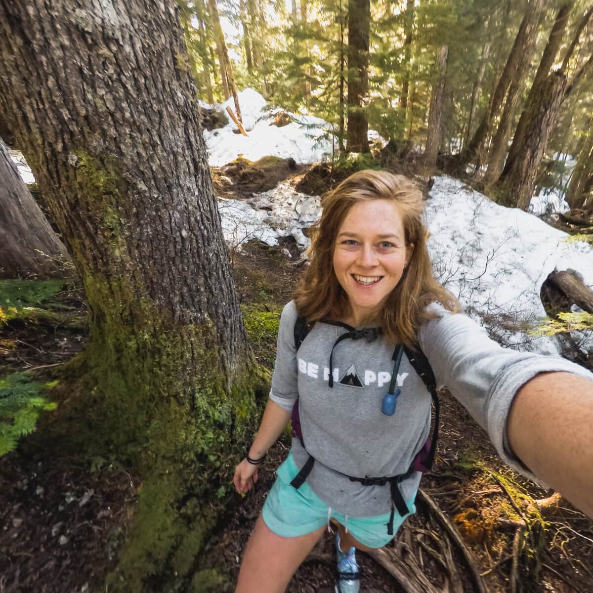
Hannah started That Adventurer after graduating back in 2013 and has documented all of her adventures since then. From backpacking South America to city breaks in Europe, a 3 month road trip across the USA in a self-converted van and 6 years living in Canada, you’ll find posts on all of this.
Hannah specialises in active travel and on That Adventurer you’ll find hiking, walking, biking, skiing and all sorts of active travel guides to allow you to see a destination in an adventurous way.
Now back in Europe, you’ll find new guides as Hannah and her husband spend the next year ‘digital nomading’ from Norway to Portugal, Switzerland to Scotland and places in between.


