
20 best Mt Rainier day hikes & backpacking trails
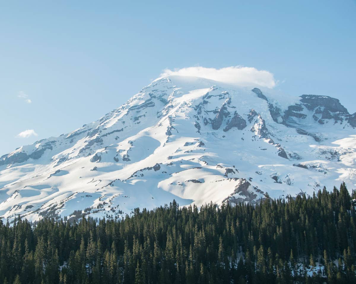
Mt Rainier National Park in Washington State is one of the best US National Parks. With beautiful views of Mount Rainier volcano, amazing trails, and plenty of things to do, our visit to Mount Rainier Washington is one of my most memorable National Park trips from our road trip across the United States.
One of the top things to do at Mt Rainier is to take a hike. Whether you’re backpacking Mt Rainier or looking for the best day hikes Mt Rainier has to offer, pretty much all the Mt Rainier day hikes will offer impressive views of Mt Rainier and the other mountains nearby.
Lots of the Mt Rainier hiking trails are also covered in wildflowers at certain times throughout the year and there are numerous clear lakes near Mt Rainier too.
If you plan to visit Mt Rainier National Park then make sure to make time for a Mt Rainier day hike. If you’re looking for something longer, Mt Rainier National Park makes a great backpacking destination!

Best day hikes in Mt Rainier National Park
Mt Rainier National Park has over 400km of trails going through lovely forests, valleys, and meadows. You’ll walk among trees, by lakes, and see beautiful glaciers while smelling fresh wildflowers.
Let’s break down the best hikes in Mt Rainier National Park based on the areas of Mt Rainier National Park Washington:
- Paradise: This is the most famous part of the park on the mountain’s southern side. It’s filled with beautiful wildflowers and has the historic Paradise Inn. If you have just one day at Mt Rainier National Park, spend it here!
- Longmire: Found in the southwest, this area has historic log cabins and dense, beautiful forests.
- Ohanapecosh: Towards the southeast, this is a quieter spot with some amazing forests. Perfect if you want to enjoy hiking with fewer people around.
- Carbon River/Mowich Lake: This is in the northwest and is a bit tough to get to. But the hiking and camping here are some of the best!
- Sunrise: On the northeast side, this is another popular spot. It gives you breathtaking views of Rainier.
Mt Rainier National Park maps
You should always carry a Mt Rainier trail map with you when hiking. While the easier, shorter hikes are usually pretty busy and well-marked this isn’t always the case.
The Mt Rainier Sunrise Visitor Center carries basic trail maps but for moderate-strenuous hikes and especially backpacking, you should have your own trail map and a compass and know how to use it.
- Mt Rainier trail map by National Geographic – a good option for an Mt Rainier hiking map!
Below, I’ve also included my Mt Rainier map which includes the best things to do in Mt Rainier as well as the best Mount Rainier hikes that I talk about in more detail below. This will help you get your bearings when planning your trip to Mount Rainier Washington.

AllTrails is my go-to hiking app for finding, planning, and navigating while I’m out on the trails. With offline maps on AllTrails+ you can be confident you’re still on the right track, even without mobile signal.
Best Hikes in Paradise Mount Rainier
Whether you’re short on time, visiting Mt Rainier with kids, or just fancy taking it easy, these easy day hikes in Mt Rainier National Park provide incredible views without leaving you too out of breath!

Nisqually Vista Trail
- Distance: 1.1 miles / 1.8 km
- Duration: 30 mins
- Elevation: 180 ft / 55 m
- Difficulty: Easy
- Trail map here.
If you’re hunting for an easy yet scenic hike in Mt Rainier National Park, Nisqually Vista Trail is a great choice. It’s definitely one of the best Mt Rainier hikes for beginners.
This hike is in the popular Paradise area and since it’s easy with great views, it’s one of the busiest. With a paved pathway, it’s not just beginner-friendly but also suitable for families with strollers or those with limited mobility.
As you walk, prepare for some short and steep inclines. But don’t worry, most find it manageable.
The real treat? The incredible views of Mount Rainier and the breathtaking Nisqually Glacier.
If you’re lucky and visit during the right season, a carpet of wildflowers and some wildlife might greet you too!

Myrtle Falls viewpoint
- Distance: 1.1 miles / 1.8 km
- Duration: 20 mins
- Elevation: 154 ft / 47 m
- Difficulty: Easy
- Trail map
For those visiting the Paradise area of Mt Rainier, Myrtle Falls Viewpoint is another must-hike trail.
Starting close to the Paradise Inn, this path is actually part of the longer Skyline Trail but you don’t have to go very far to get awesome views of Myrtle Falls.
The trail is also paved throughout so it’s great for families even if you’ve got a stroller.
As you walk, make sure to take a short detour for a closer look at Myrtle Falls. Then, once you rejoin the main path, a mere 100-foot walk rewards you with a grand view of Mount Rainier set against the backdrop of Edith Gorge.
It’s no surprise that Myrtle Falls which drops 72 feet into a gorge, is one of the park’s most photographed spots!

High Lakes Loop trail
- Distance: 2.8 miles / 4.5 km
- Duration: 1.5 hours
- Elevation: 551 ft / 168 m
- Difficulty: Moderate
- Trail map
Starting near the Paradise Inn, the High Lakes Loop trail has a few challenging steep inclines which are well worth the effort.
When you reach Faraway Rock overlook, a viewpoint that on a clear day, gives you mirror-like lake reflections, you’ll forget any huffing and puffing you did on the incline and get to enjoy an incredible view of Mt Rainier.

Comet Falls Trail / Van Trump Park Trail
- Distance: 3.5 miles / 5.6 km
- Duration: 2.5 hours
- Elevation: 1 286 ft / 392 m
- Difficulty: Hard
- Trail map
The Comet Falls Trail via Van Trump Trail is a steep and challenging hike that takes you out to one. of the tallest waterfalls in Mount Rainier National Park.
The waterfall is said to look a little like the trail of a comet, hence the fall’s name.
You’ll start off by hiking through a dense forest with some small waterfalls along the way, then you’ll come out to Comet Falls. If you want to continue hiking, you can also go up to Van Trump Peak where you’ll get some incredible views out over the park.

Bench and Snow Lakes
- Distance: 2.2 miles / 3.5 km
- Duration: 1 hour
- Elevation: 449 ft / 137 m
- Difficulty: Moderate
- Trail map
The Bench and Snow Lakes Trail is a good family-friendly hike in Mount Rainier National Park where you’ll head through a beautiful meadow area before coming out at Bench Lake.
If you’re lucky with the weather, you can get the most amazing reflection of Mt Rainier in the water!
Then, continue on to visit Snow Lake which is surrounded by amazing views of mountain peaks and pine trees. There’s something so peaceful about this part of the park and it’s a special place to visit.

Paradise Glacier Trail
- Distance: 3.5 miles / 5.6 km
- Duration: 1.5 hours
- Elevation: 1 122 ft / 342 m
- Difficulty: Moderate
- Mount Rainier Trail map
The Paradise Glacier Trail is a great day hike at Mt Rainier if you’re looking for something quieter as this trail offers an escape from the bustling crowds.
As you hike, you’ll go through a series of trails interconnecting the subalpine meadows of Paradise and get some great views to the south of Mt St Helens and Mt Adams on a clear day.

Skyline Trail Loop Mt Rainier
- Distance: 5.7 miles / 9.2 km
- Duration: 3.5 hours
- Elevation: 1 768 ft / 159 m
- Difficulty: Hard
- Trail map
The Skyline Trail is one of the best hikes in the park and also one of the most popular hikes at Mt Rainier.
The loop can be done in either direction, but most hikers choose the clockwise route. If you don’t want to do the full loop, you can go to Panorama Point and then turn around back the way you came; but where’s the fun in that?!
On clear days, Oregon’s Mt Hood can even be spotted in the distance!
Doing this loop is the hike I recommend the most since you’ll get incredible views and you’ll pass some of the other Mt Rainier trails listed in this guide too, such as Myrtle Falls.

Camp Muir Route via Skyline
- Distance: 8.8 miles / 14.2 km
- Duration: 7.5 hours
- Elevation: 4 665 ft / 1 422 m
- Difficulty: Hard
- Trail map
This hike isn’t for the faint-hearted but you’ll have such a sense of achievement by the end as well as a camera full of incredible photos after this hike.
This trail takes you out to Camp Muir which is the base camp for those who are summiting Mount Rainier. From here you’ll get a glimpse into the world of mountaineering which is pretty cool.
The trail starts with the Skyline route but then turns off onto a more challenging path.
As you head uphill it’s likely you’ll come across some snow so make sure you’re prepared.
If you’re not planning to summit, this is the closest you can get to Mount Rainier’s peak without a permit.

Best Hikes in Ohanapecosh Mount Rainier
In Ohanapecosh at the southeastern corner of the park, you’ll find yourself amongst super old forests. While it’s not the best place in the park for views of Mt Rainier itself, there’s something special about walking among the giants.
Grove of the Patriarchs
- Distance: 1.1 miles / 1.8 km
- Duration: 20 mins
- Elevation: 52 ft / 16 m
- Difficulty: Easy
- Trail map
Note: This trail is currently closed due to damage to the bridge. Always consult the National Park Service website for the most recent updates before planning your hike.
Walking the Grove of the Patriarchs trail is almost like walking through a museum.
This easy and short family-friendly trail is mostly flat and takes you through the forest and among the ancient red cedars, Douglas firs, and western hemlocks, some of which have stood for over a thousand years.
The trail also includes a crossing over a suspension bridge before stepping onto a boardwalk amongst some of the oldest trees in the area.

Silver Falls Loop
- Distance: 2.9 miles / 4.7 km
- Duration: 1.5 hours
- Elevation: 522 ft / 159 m
- Difficulty: Easy
- Trail map
The Silver Falls Loop is the hidden gem of the Mt Rainier area and is usually pretty quiet in terms of crowds.
The relatively short trail takes you through an old-growth forest and you’ll also hear the relaxing sounds of the river as you walk.
Before long, you’ll come out to the beautiful Silver Falls where there are moss-covered rocks and, if the flow isn’t too fast, a beautiful place to take a dip and cool off on a hot day.
Best hikes in Sunrise Mt Rainier

Dege Peak trail
- Distance: 2.8 miles / 4.5km
- Duration: 1 hour 40 mins
- Elevation: 807 ft / 246 m
- Difficulty: Moderate
- Trail map
For a relatively easy hike in Mt Rainier with incredible views, the Dege Peak Trail is ideal.
You’ll go through some stunning subalpine meadows which have the most incredible wildflowers at times of the year. Then, you’ll make your way up to the peak to be rewarded with views of Mount Rainier, Glacier Peak, and Mount Adams.


Glacier Basin Trail
- Distance: 8 miles / 13 km
- Duration: 4-5 hours
- Elevation: 2 346 ft / 715 m
- Difficulty: Hard
- Trail map
The Glacier Basin Trail takes you through the forest which is often full of huckleberries in the summer before coming out to a basin and beautiful meadows which go for as far as you can see.
There’s also a lake and the Emmons Glacier as the backdrop of the trail. If you wish you can extend this hike by adding on the branch out to the Emmons Glacier moraine for slightly different views.

Sourdough Ridge trail to Frozen Lake
- Distance: 2.8 miles / 4.5 km
- Duration: 1.5 hours
- Elevation: 535 ft / 163 m
- Difficulty: Moderate
- Trail map
The Sourdough Ridge Trail to Frozen Lake is easily one of the best hikes in Mount Rainier National Park.
Starting at the Sunrise parking lot, the trail intertwines with the Sunrise Nature Trail and then takes you onto the Sourdough Ridge Trail with Mount Rainier dominating your view.
What makes this trail particularly special is the almost constant, up-close view of Rainier.

Burroughs Mountain Loop Trail
- Distance: 9.5 miles / 15.3 km
- Duration: 5 – 6 hours
- Elevation: 2 601 ft / 793
- Difficulty: Hard
- Trail map
Starting also from the Sunrise Parking lot, the Burroughs Mountain Trail is a challenging hike that takes you up to Frozen Lake, before heading up and up on what feels like a summit trail.
Almost the entire way you’ll get views of Mt Rainier and you’ll also see the White River. and the Emmons Glacier.
As you reach the First Burroughs Mountain plateau you’ll get spectacular panoramas which are some of the best views in the park.


Mount Fremont Fire Lookout
- Distance: 5.7 miles / 9.2 km
- Duration: 2.5 – 3 hours
- Elevation: 1 109 ft / 338 m
- Difficulty: Moderate
- Trail map
The Mount Fremont Fire Lookout hike is the one hike to do in Mount Rainier if you only have one day.
It’s not too difficult and it takes you along some of the best parts of the Sourdough Ridge Trail, before heading to the Fremont lookout which is an old fire tower in the park.
From the end of the Mount Fremont Lookout Trail, you get incredible views of Mt Rainier as well as the forest and lakes at its base and other peaks of the Cascade Mountain Range.
Best Hikes in Carbon River Mount Rainer
For those who prefer the path less traveled, the Carbon River area of Mount Rainier National Park offers a greater chance to escape the crowds.
Despite its remote nature, access is fairly straightforward via the 17-mile Mountain Meadows Road which most cars can manage.

Tolmie Peak Fire Lookout
- Distance: 4.6 miles / 9 km
- Duration: 3 – 3.5 hours
- Elevation: 1 555 ft / 474 m
- Difficulty: Moderate
- Trail map
The Tolmie Peak Fire Lookout starts along the picturesque banks of Mowich Lake and then takes you through a dense pine forest. It’s so worthy of being considered one of the best hikes near Mt Rainier
Further on, the path passes the clear green waters of Eunice Lake which makes a beautiful place for a rest before heading up to the Tolmie Peak Trail to the Lookout.
From up at the lookout you’ll get great views of Eunice Lake below as well as the majestic Mount Rainier itself.
The best times to embark on this trail are during late summer when wildflowers adorn the path, or in the fall for the gorgeous autumn colors.

Naches Peak Loop Trail
- Distance: 3.5 miles / 5.6 km
- Duration: 1 – 2 hours
- Elevation: 659 ft / 201 m
- Difficulty: Moderate
- Trail map
The Naches Peak Loop is a relatively short trail with some amazing views starting from Tipsoo Lake.
The ascent is somewhat challenging as it zigzags up a hillside but in the summertime, you can forget about the climb and enjoy the wildflowers instead.
After the initial climb, the trail flattens out a little as you go through the meadows enjoying the amazing views.
The best way to approach this hike is in the clockwise direction, ensuring Mount Rainier remains in your sight, offering a constant visual treat.
Best Mt Rainier backpacking trails
There’s lots of backpacking to be done in Mt Rainier National Park but before you go, make sure you read up on the regulations regarding food storage and wilderness permits on the National Parks Service site.
Backcountry permits for Mt Rainier National Park
If you wish to explore the backcountry hiking trails in Mt Rainier National Park and do some overnight Mt Rainier camping, you’ll need to get a wilderness permit.
It’s recommended that you make a reservation to get a wilderness permit which reserves you a specific wilderness camping site for the night. The permits available to reserve fill up quickly during summer.
About 70% of permits are allocated for reservation and 30% are kept back for first-come, first-served customers.
Reservations open in March each year and The Wonderland Trail, in particular, is extremely busy. Because of this, reservation requests are usually not accepted after the 1st of April for this Mount Rainier hiking trail.
Confirmed reservations cost $26 for the best backpacking Mount Rainier experience.
Backcountry hikes in Mt Rainier National Park
Here are a few popular backcountry routes in Mt Rainier National Park for some inspiration.
The Wonderland Trail Mt Rainier
- Distance: 86 miles / 138.1 km
- Duration: 9-14 days
- Elevation: 24 547 ft / 7 482 m
- Difficulty: Hard
- Trail map
The Wonderland Trail winds its way around the entirety of Mount Rainier and is one of the best backpacking trips in the USA.
Every step on this trail offers a new view of Mount Rainier. You’ll pass historic cabins, see glaciers, pass by trickling streams, and be wowed by nature the entire time.
To do the entire trail takes most people between 9 to 14 days and there’s quite a bit of planning involved when it comes to resupply since you’ll need to carry all your food.
However, you can also hike this in sections, with many choosing to do a smaller part like the trail from Longmire to Mowich Lake.
Permits are required for anyone wishing to set up camp along the Wonderland Trail and these permits aren’t easy to come by. The high demand typically leads to an early access lottery held in late February and early March.
Find out more about hiking the Wonderland trail in Mt Rainier National Park
Mt Rainier summit hike
Climbing Mt Rainier is a once-in-a-lifetime experience for experienced mountaineers with glacier and avalanche knowledge. Reaching the top of Mt Rainier on a summit climb is usually a four-day expedition that’ll push and challenge you as you climb over 2,700m to the summit of Mt Rainier.
If you’re interested in doing a Mt Rainier summit hike but don’t have the knowledge to hike it solo then take a look at RMI guides who run expeditions and are great Mt Rainier guides.
Mowich Lake to Mystic Lake
The Mowich Lake to Mystic Lake trail is a 23-mile / 36.7 km backpacking trail that takes you past Mowich and Mystic lakes and offers panoramic views of Mt Rainier and the Carbon Glacier.
It’s not an easy hike but it’s very rewarding and you’ll see the famous Spray Park, Mowich and You’ll see on this hike, the famous Spray Park trail, Mt. Rainier up close, lakes, and more.
Along the way, you’ll cross a variety of terrain including the Carbon River suspension bridge which takes you over the lowest glacier in the U.S., The Carbon Glacier.
Up you go again along the glacier to the beautiful meadows at Moraine Park.

Best time to go hiking in Mt Rainier National Park
If your main reason for visiting Mt Rainier is to go hiking, then you’ll need to take the following into consideration when planning the best time to visit Mt Rainier.
Spring (Late April – June): Spring sees a gradual melting of the snow depending on how harsh the winter was. Lower elevations see temperatures ranging from mid-30s to 60s°F (2 to 15°C) while higher elevations remain cold and snowy. Many trails, especially at higher elevations, are still covered in snow and snowshoes might be necessary for some. The road to Paradise is usually open but many others, including Sunrise, won’t open until late June or early July.
Summer (July – Early September): Summer is the driest and warmest season with temperatures at lower elevations ranging from the 50s to 80°F (10 to 27°C) and 40s to 70s°F (4 to 21°C) at higher elevations. Most trails are snow-free by mid to late summer but it’s the most popular time to hike, so trails can be crowded. Most park roads, including the ones to Sunrise and Paradise, are open and this is the best time to view wildflowers, especially in the Paradise area. Be sure to make reservations early if you’re planning on camping.
Fall (Mid-September – October): The weather becomes cooler and wetter and temperatures can range from the mid-30s to 70°F (2 to 21°C) at lower elevations and can be much colder at higher elevations. During fall in Mt Rainier, trails start seeing snowfall, especially in late fall and some might require snowshoes by late October. The Sunrise Road typically closes in mid-October or with the first heavy snowfall and other roads start closing or become inaccessible due to snow.
Winter (November – April): Winter brings cold conditions with temperatures often below freezing, ranging from the low teens to mid-30s°F (-10 to 2°C) at lower elevations. Higher elevations are even colder. Most trails are snow-covered and require snowshoes or skis. Avalanches can be a risk in certain areas. Many park roads, including the road to Sunrise, are closed. The road to Paradise is open but requires tire chains to be carried. You can also go snowshoeing, skiing, and sledding but be aware of winter hazards and always check avalanche forecasts.
While Mount Rainier offers spectacular views all year round, the best time to hike without winter gear is during the summer months. Always check with the National Park Service for the latest trail and road conditions, as well as any alerts or advisories, before embarking on your trip.
What to pack for Mt Rainier hikes
Below is an overview of the things you should consider packing for your trip. Of course, this will change a bit depending on your plans for your Mt Rainier trip.
You can also take a look at my packing list for day hikes.
Essential Gear:
- Backpack: A good-fitting backpack, ranging from 20-70 liters depending on the duration and type of your hike.
- Hiking Boots/Trail running shoes: Waterproof and comfortable with good traction.
- Water: At least 2 liters, more for longer hikes, and a water filter or purifying tablets. I use a water bladder as well as a reusable bottle.
- Food: Trail mix, energy bars, dried fruits, and freeze-dried meals for multi-day hikes.
- Emergency Shelter: A lightweight tarp, bivvy sack, or emergency blanket.
- Rain Gear: Waterproof jacket and pants are a good idea for hiking in the PNW.
- Warm Clothing: Even in summer, temperatures can drop, especially overnight; pack a fleece/wool hat, gloves, and a down or synthetic jacket.
- Multi-tool or Knife: Useful for repairs and food preparation.
- First Aid Kit: Including band-aids, antiseptic wipes, blister treatment, pain relievers, and any personal medications.
- Headlamp: With extra batteries and/or a charging pack.
- Sunglasses and Sunscreen: UV protection is crucial even on cloudy days.
- Trekking Poles: Helps with balance and reduces strain on knees during descents.
Personal Items:
- ID and Permits: Carry identification and necessary permits for overnight stays.
- Cash/Credit Card: For park fees or services.
- Personal Hygiene: Toothbrush, toothpaste, biodegradable soap, hand sanitizer, and personal toiletries.
- Toilet Paper and Sanitation Trowel: Always follow Leave No Trace principles and bury human waste 6-8 inches deep.
Camping Gear (For Multi-Day Hikes + Mount Rainier backpacking):
- Tent: Lightweight and weather-resistant with stakes and guylines.
- Sleeping Bag: Suited for the coldest temperature you might encounter.
- Sleeping Pad: Insulates you from the ground and provides cushioning.
- Stove and Fuel: Check fire restrictions if planning to use a stove.
- Cooking Utensils: Lightweight pot, cup, spork, and possibly a bowl.
- Biodegradable Dish Soap and Scrubbing Pad: For cleaning your utensils.
- Bear Canister or Hanging Bag: To protect your food from wildlife.
Optional but Helpful:
- Camera: With extra batteries or a power bank.
- Notebook and Pen: For journaling or making notes.
- Insect Repellent: Especially during the summer.
- Gaiters: To prevent debris or snow from getting into your shoes.
- Extra Ziplock Bags or Dry Bags: For organizing and keeping items dry.
- Guidebook: Providing extra information about the trail and surrounding areas.
Remember to always check current conditions, including weather and trail status, before heading out. Adjust your packing list accordingly based on the specific conditions and requirements of your trip.

What to know before hiking M Rainier National Park WA
Before you go hiking in Mt Rainier, there are some important things to bear in mind including the following:
- Permit Requirements: A Wilderness Permit is needed for all overnight camping in the backcountry. Some day hikes in popular areas may also require permits.
- Weather Unpredictability: Mount Rainier is known for its rapidly changing weather conditions. Always check the forecast and be prepared for a sudden change.
- High Elevation: The high elevation can affect hikers not used to it, leading to altitude sickness. Acclimatize and stay hydrated.
- Trail Difficulty: Many trails are strenuous with significant elevation changes, so assess your physical condition and choose trails accordingly.
- Wildlife: You might encounter wildlife, including bears and mountain lions. Know the safety protocols, such as storing food properly and what to do if you come across these animals.
- Avalanche Risk: Some areas, especially in winter, are prone to avalanches. Check avalanche forecasts and be knowledgeable about identifying avalanche-prone areas before heading into them.
- Water Sources: While there are many streams, it’s essential to either carry enough water or have a way to purify natural water sources.
- Proper Footwear: Trails can be rocky, steep, and, in some areas, snowy or icy. Wear sturdy hiking boots with good traction.
- Road Closures: Depending on the season, some access roads may be closed. Check with the National Park Service for current road conditions.
- Limited Cell Service: Many areas of the park have limited or no cell service. Inform someone about your hiking plans and expected return time.
- Leave No Trace: Follow Leave No Trace principles to minimize your impact on the environment. Pack out all trash and avoid making new fire pits.
- Wildflower Etiquette: If visiting during wildflower season, stay on designated trails to protect delicate meadows.
- Parking: Popular trailheads fill up early, especially during the summer. Arrive early or consider using park shuttles.
- Winter Considerations: If hiking during the winter months, you’ll need specialized gear such as snowshoes or skis, and potentially avalanche safety equipment.
- Navigation: While many trails are well-marked, always carry a map and compass and know how to use them.
- Camping: If you’re planning to camp, be aware of designated camping zones and camp only in established sites.
- Check-in/out: If you’re doing a longer or more isolated hike, consider checking in with a ranger before you start and once you finish.
- Mt Rainier Entrance Fee: The Mt Rainier entrance fee is $30. This gives unlimited entry for 1 vehicle over the course of seven consecutive days. If you’re visiting by bike or on foot then a pass costs $15. Alternatively, get the American Parks Pass for $80 for a year and access to all national parks and monuments.
How to get to Mt Rainier National Park?
Mt Rainier National Park is in Washington State, USA. It’s around 138 miles north of Portland and the distance from Seattle to Mt Rainier is between 55-90 miles depending on which of the Mt Rainier entrances you arrive at.
Here’s how you can get to Mount Rainier National Park from both Seattle and Portland:
From Seattle to Mt Rainier National Park
- Airports: The nearest major airport to Mount Rainier National Park from Seattle is Seattle-Tacoma International Airport (SEA).
- Driving Directions: From Seattle, it’s a straightforward drive to the park on I-5 South from Seattle, exiting onto WA-512 E toward Puyallup.
- Distance and Duration: The driving distance from Seattle to the Nisqually Entrance of Mount Rainier National Park is approximately 80 miles (129 km), and it typically takes about 2 hours to drive, depending on traffic conditions.
Because of its location, it’s possible to do a Mt Rainier day trip from Seattle without too much effort.
I use comparison sites like DiscoverCars and RentalCars to book my car rentals as it’s easy to check prices and compare the best deals!
Portland to Mount Rainier
- Airports: The nearest major airport to Mount Rainier National Park from Portland is Portland International Airport (PDX).
- Driving Directions: From Portland, the drive is a bit longer, but still direct along the I-5 North towards Seattle and then exit 68 for US-12 toward Morton/Yakima. Turn right onto US-12 E and then left onto WA-123 N (Cayuse Pass) connecting later with WA-410 E into the park. If Cayuse Pass is closed, take US-12 E turning right onto WA-7 N towards Elbe going through the Nisqually Entrance.
Do note that driving times can vary significantly based on weather conditions, especially during the winter months. Always check for road closures and weather updates before heading out.

Where to stay near Mt Rainier National Park
Below are some suggestions on where to stay when visiting Mount Rainier National Park.
- Stormking Hotel: With private parking and amenities like a hot tub, garden, and BBQ facilities. All rooms have a TV, a private bathroom with a hot tub, and kitchen amenities like a fridge and microwave.
- Cozy Apartment: A quiet street-view apartment 49 km from White River Amphitheatre, featuring amenities like a patio, balcony, equipped kitchen, and a hot tub, with opportunities for nearby skiing and cycling.
- My Place Hotel: Great hotel with a shared lounge, barbecue facilities, and an array of room amenities, with nearby outdoor activities available.
- Mountain Meadows Inn: This inn offers a sun terrace, garden views, free WiFi, and flat-screen TVs in rooms, with select units including a relaxing seating area.
- Cowlitz River Lodge: This lodge provides mountain views, a garden, a shared lounge, and rooms equipped with modern amenities and a seating area.
- LOGE Alta Crystal Resort at Mt Rainier: A 4-star property in Enumclaw, this resort offers ski facilities, an outdoor pool, a hot tub, evening entertainment, and proximity to hiking, skiing, and fishing.
FAQs about best day hikes Mt Rainier National Park
Do I need bear spray in Mt Rainier?
Is Mount Rainier a difficult hike?
Are there easy hikes in Mt Rainier National Park?
What is the hardest hike in Mount Rainier National Park?
What is the longest trail in Mount Rainier National Park?
Where is the best place to hike in Mount Rainier National Park?

Final thoughts on hiking Mt Rainier National Park Washington
Mount Rainier offers some of the most majestic and challenging hiking opportunities in the U.S. Whether you’re a seasoned hiker looking for your next adventure or looking for easy walks in beautiful surroundings, you can find easy and hard hiking trails at Mt Rainier depending on what you’re looking for.
Personally, I think the best hike in Mt Rainier is any of the Skyline Trail – it’s so hard to beat those views!
If you’re doing a West Coast USA road trip and looking to visit more national parks then check out this guide to visiting North Cascades National Park, the best hikes in the North Cascades, where to stay for the North Cascades National Park, and this guide to Bellingham, which is a super cool town just across the border from Vancouver, BC.
Last Updated on August 16, 2023 by Hannah

Hannah started That Adventurer after graduating back in 2013 and has documented all of her adventures since then. From backpacking South America to city breaks in Europe, a 3 month road trip across the USA in a self-converted van and 6 years living in Canada, you’ll find posts on all of this.
Hannah specialises in active travel and on That Adventurer you’ll find hiking, walking, biking, skiing and all sorts of active travel guides to allow you to see a destination in an adventurous way.
Now back in Europe, you’ll find new guides as Hannah and her husband spend the next year ‘digital nomading’ from Norway to Portugal, Switzerland to Scotland and places in between.


I am thinking of going to Mt. Rainer in March (most likely the first week). Are any of the shorter hikes usually open that time of year or is it all weather-dependent?
Hey! Some of the easier hikes listed here with lower elevation should be snow-free or have hard packed so so they’ll be easier to walk. Some of the moderate ones may be okay but it’d be best to check the conditions or pop into the visitor centre when you visit just to get an update 🙂 Sure it’ll be beautiful either way!